
WARDOGS Zestafona Map and Terrain Guide
Explore the WARDOGS Zestafona terrain map, search 56 working-name locations and read practical route-planning notes with clear test-build limitations.
FAQ
Can I zoom the Zestafona map?
Are the Zestafona locations official names?
Does this show a live Zestafona match?
Is Zestafona available in the current build?
Source snapshot: Public WARDOGS Field Guide, reviewed September 14, 2026. Official announcements and historical community test-build data are distinct; prices, availability and planned features may change.
ALPHA / BETA TERRAIN REFERENCE
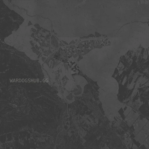
Zestafona terrain atlas
Working names from test-build terrain. Current server rotation and in-game names have not been independently verified.
56 locations
Post-launch scope check
The September 10–14 official updates reviewed for this site do not validate this terrain’s full live availability, every coordinate or every working name. The original September 10 community snapshot remains intact; no current server rotation or terrain change is inferred from a server-browser patch.
Reading Zestafona’s terrain
An exposed landscape with sparse vegetation, field blocks and developed sites. The terrain and working-name records include rail facilities, warehouses, factories and water infrastructure.
-
Open ridges and low vegetation offer less continuous canopy than the forested valley record.
-
Agricultural parcels and developed sites provide more distinct navigation references.
-
Industrial and rail-related working names make up a substantial part of the location list.
Route-planning considerations
The following is practical planning advice inferred from the terrain, not a tested competitive route or a guarantee of live-build cover.
-
Treat long, open approaches as a planning risk until you can assess them in game. Avoid assuming a broad empty area is safe simply because it has no marker.
-
Use large industrial landmarks to coordinate a meeting point, but verify entrances and accessible interiors after spawning.
-
Do not read these notes as a tested optimal route. This is terrain-based planning advice; objective placement, playable rotation and real combat cover still need live-build verification.
Source status: Time-sensitive.
Availability and naming
A community terrain dataset exists, but the reference site’s availability notices contain older beta wording. We do not treat that wording as a verified live or launch status.
Location names and positions are taken from a community snapshot of test-build map records. They are useful callouts for this viewer, but are not developer-confirmed final names.
What this map cannot tell you
-
The current match’s Control Zone, Hot Zone, safe zones or team positions.
-
Whether a bridge, road, building entrance or interior is usable in the current build.
-
Live vehicle, vendor, fuel, enemy or player-built structure locations.
-
A guaranteed best route, spawn location or launch-day server rotation.
Related briefings
Sources and references
Related Articles
guides
WARDOGS Beginner Guide: How the Battle Works
A source-backed WARDOGS beginner guide to the three-team objective, 100-point win condition, persistent cash, custom roles, vehicles, logistics and building.
guides
WARDOGS Building Guide: FOBs, Fortifications and Destruction
Learn confirmed WARDOGS building mechanics: construction items, FOBs, defensive positions, chokepoints and destructible structures.
guides
WARDOGS Cash Guide: Earning, Spending and Persistence
A confirmed-mechanics guide to WARDOGS cash: the $10,000 starting balance, persistent money, per-life loadout purchases, team-action rewards and Hot Zone bonus.
Was this helpful?
Thanks for the feedback!